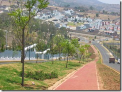
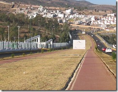
As you can see in these two photos, the main avenues up here in Altozano are getting spruced up.
Quite a few people have written to me lamenting about the construction up here destroying the forests.
 However, the area where Altozano is being built was mainly pastures. If there were forests here, they were destroyed decades, if not centuries ago. The only area that I would call wooded is where the golf course is being built.
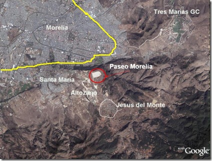
This google satellite photo below shows some of the wooded areas that hopefully will be somewhat protected from growth in the future. It will also give some of you that are not so familiar with Morelia an idea of just how close some of these projects are to one another.
The wooded area between the labels Paseo Morelia and Jesus del Monte is the Valle del Rio Chiquito reserve. The yellow line is Camelinas Blvd (aka Libremiento)

The dark woods in the lower right hand corner are the beginnings of the forested areas that include the small towns of San Miguel, San Jose de los Torres, Rio Bello, Ichaqueo, Tumbisca. This area is the main watershed for Morelia.
The little finger that juts out to the upper left of the red circle is the Loma de Santa Maria hillside at the southern part of the city.

2 comments:
Last summer I went to Morelia and I saw some signs of a park that was going to be build. This park will have an artificial lake and wooded areas, have you heard anything about this? If so, please post pictures of this place, I was amazed by the type of development specially in this city. Greetings from Canada!
Hi Armando, yes I remember those signs. I think the park's location was to be on the road to Quiroga. I will try to get more information on it. I have not heard anymore about it, probably due to the changing administration here. It seems to be taking Godoy a long time to get his people in place here. The Federal funding is there, but he seems to be dragging his feet on things. Gee, could it be political? ;)
Post a Comment